Left LaPaz and rode to Oruro today. 3 hours of high plains (alta plaino) riding. Our altitude was fairly constant at about 3900 meters (12,800 ft) Roads were better than expected and signage was too. Got into Oruro and needed a small screw for my antenna and directions to a good hotel. These guys helped with both. they were very nice. One guy got directions and drew us a map. Now I'm blogging...
November 8, 2010
"Death Road" here we come. After figuring out how to get unto the highway and running another gambit through another "cluster fuck" which we were much more able to manoeuvre because our side panniers were left at the hotel, therefore much narrower and lighter. We did as the local did and split lanes and weaved between stopped taxis and passed trucks on speed bumps (tapas). Then up up up and away. The pass peached out at 4669 metres (15,400ft) Talked to some people riding mountain bikes, with all the gear and carried on. There was the first Yungas Rd turnoff and as we deliberated about going down it, a bus was coming up. There are no buses allowed on "The Road of Death" so this bus ruled out this first road and we carried on. After Chapata, we noticed some mountain bikers heading down this other road and figured we should follow. Stopped and talked to their guide who confirmed we were on the right road. 1 km further confirmed our insights with this sign confirming the Death road. The road is about 30 kms and it is spectacular. Nearly vertical mountain slopes in many areas and we went from dry alta plaino desert vegetation to jungle vegetation in 50 kms Went from 46ºf @ 3600 meters (11,800ft) to 93ºf @ 1000 meters (3280 ft) in the same time. Rode under a few waterfalls. Then we went up to Coroico, 9kms up lousy gravel and cobblestone. Had lunch there. We ordered hamburgers and after an hour they finally came with no bun. There was no bread in town. Oh well? Then we returned on the new road that was opened in 2007. There is still a lot of repairs needed to the road but quite cool. As we were riding back to the hotel, there were many switchbacks, gravel stretches and repair work. but what a road. At one point the road crested the mountain and you could see gorgeous valleys on either side of the ridge then we went into a 1.4 km long tunnel. It was trying to rain and getting cold and in the tunnel was emergency pull outs where Michael and I stopped and got out our rain gear. Ended up the only thing it was used for was to cut the cold as we ascended to the pass. While ascending, cloud were being blown up the mountain and on 2 occasion the clouds created a visual vortex as they hit the lip of the road. We both commented how cool it looked. You had to be there, i guess…. Back in town, we bought groceries enough for dinner and lunch the next day for $b86 ($12.75can) including 2 beer each.


We moved into LaPaz. After riding around town for a couple of hours trying to find accommodations with wifi, we finally found the one we are at now. Talked to Julie and the WiFi keeps cutting out. What a pain the in then ass. After reading my Lonely Planets book this morning, it sound like internet and ATMs are relatively sparse in Bolivia. So you will get what you get. Tomorrow, we are going to find the "worlds most dangerous road" and ride it if we can. Some have said that only bicycles are allowed down it now, but we will check it out. Tried for 2 hours to hook into the internet this afternoon so that we could talk to friends and family at our house for Miranda's 22nd Birthday Party. We missed out and I am upset with not having access to the internet when we needed very much. Walked up town and found a pizza joint. A large pizza, bread sticks and 2 beer cost $b110 ($15.75can). It was good too. The area of LaPaz we saw is more than I expected. Cleaner and more exciting and we felt quite safe, but didn't take any chances, so we were in before dark.


Got our bikes loaded before the tour and was picked up on time. The tour lasted about 3 hours and was very informative. The people who started building these reed rafts (islands) initially headed into the swamps and into reeds to hide from the Spaniards. They developed a culture away from everyone else and eventually started building these rafts. The rafts have a life expectancy of about 25 years and takes a family about a year to build a new one. Tourism is a major supplement to their economy and appears to be doing them very well. One young lady showed us her room that she shares with one of her sisters. Then we had to buy some hand sown pillow sham to help support them.


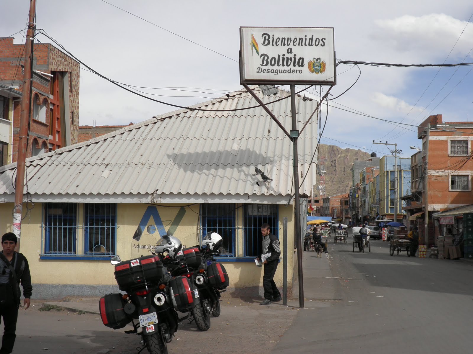
After getting back from the tour, we got on our bikes and headed for the frontier (border). 2.5 hours later riding over another 4000meter pass, we arrive at the border town and am surprised to see how busy it is. We figured out that many trucks do not cross the border, but instead off load their cargo and put the cargo onto 3 wheeled bicycles with flat decks built on them and people wheel the cargo across the border and reload trucks on the other side. Simply amazing. It took us about 1.5 hours to cross the border and import our bikes, relatively painless and then down the road to LaPaz, Bolivia. We made it to El Alto (a suburb of LaPaz) about 6:30pm their time and what (excuse my Bolivian) a cluster fuck. Taxis off loading and picking up fares 4 lanes wide in each direction. People weaving between stopped and moving cars, People selling their wares, produce ad anything else that might be sellable from the side of streets, middle of streets and bridges… Finally, we needed to find accommodations before dark and asked a taxi to show us to a good hotel with parking. I can only hope that was not one of the better ones in town. The manager could speak english, but there was a night club one floor below us. NOISY or what. Even with my earplugs in, I could still hear the night club and the perpetual honking of taxi horns.

Check out all of our pictures, just click on this link.
No comments:
Post a Comment